Fisher Nicholson Realty Blog
 RSS Feed
Subscribe and receive email notifications of new blog posts.
RSS Feed
Buy a House | 36 Posts
Home Improvement | 23 Posts
Homeownership | 47 Posts
Klamath Basin | 39 Posts
Klamath Falls, OR | 77 Posts
Sell a Home | 19 Posts
May
5
5
Backpacking Trips Around the Klamath Basin
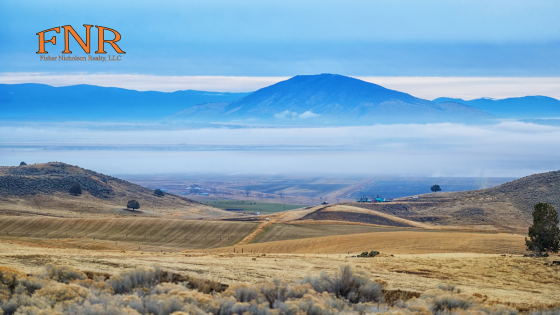
Surrounded by millions of acres of pristine National Forest land, the Klamath Basin offers some of the best backpacking trips in the United States. Thousands of miles of trails crisscross Southern Oregon, and our real estate agents are here to share some of their favorite routes near Klamath Falls.
- PCT: Oregon Section B - 11655-11001, Pacific Crest National Scenic Trail, Ashland, OR 97520
The Pacific Crest Trail stretches roughly 2,560 miles from the United States' southern border to its northern border, traversing California, Oregon, and Washington in their entirety. The trailhead marking the beginning of Oregon Section B of the trail is just 90 minutes west of Klamath Falls, and it's a stunning hike. This particular section extends 51.8 miles from Highway 5 to Highway 140 just west of Fish Lake. With campsites and trail shelters along the way, it's a spectacular three-day backpacking trip with options to continue further. - Sterling Mine Trail - 9500 Little Applegate Road, Jacksonville, OR 97530
Following the course of the historic Sterling Mine Ditch, which carried water to the Sterling Creek Mine in the late 19th century, the Sterling Mine Trail is a scenic and challenging hike located on public Bureau of Land Management property. Meandering through densely forested mountains and valleys, this point-to-point trail covers 34 miles round-trip, with 3,303 feet of elevation gain. It can be traveled one way as a day hike, or out-and-back as an overnight backpacking trip. - Brown Mountain Loop - NF-3640, OR-140, Klamath Falls, OR 97601
Just a short drive from many Klamath Falls homes for sale, the beautiful Brown Mountain Loop encircles its namesake peak, forming a 19.1-mile loop that begins at the High Lakes Trail West Access trailhead just west of Lake of the Woods in the Fremont-Winema National Forest. Gaining 1,870 feet in elevation, the trail can be completed as a strenuous day hike or a leisurely two-day trek, with options to explore numerous side trails. - Rogue Wolf Loop - NF-3790, Prospect, OR 97536
Exploring the headwaters of the Rogue River, the Rogue Wolf Loop begins at the remote Middle Fork Trailhead in the Fremont-Winema National Forest. This route uses several different trails to form a 26.3-mile loop. It's a seldom-used trail considered a challenging hike, making it ideal for hardy backpackers who want to be far from the crowds. - PCT + Crater Lake Loop - Munson Valley Road, Crater Lake, OR 97604
Crater Lake is one of the true natural wonders of the Pacific Northwest, and it's just an hour north of Klamath Falls. This 31.9-mile loop utilizes portions of the Pacific Crest Trail and the Rim Trail in Crater Lake National Park to form a circuit that offers spectacular views across the lake. It's a fairly challenging route that is best tackled as an overnight backpacking trip. It begins by following the Annie Creek Spur Trail to the Pacific Crest Trail from the Mazama Village and Campground. - OC&E Woods Line State Trail - Klamath Falls, OR 97603
Totaling 100 miles in length, the OC&E Woods Line State Trail begins in the heart of Klamath Falls and cuts a path eastward along the former grade of the OC&W and Weyerhaeuser railroads. Initially easy and level, the trail eventually crosses a few modest hills, gaining a few hundred feet of elevation as it crosses Switchback Hill. The first 63.6 miles between Klamath Falls and Bly make for a lovely backpacking trip.
Contact us today to learn more about life in the Klamath Basin. It's one of America's great destinations for outdoor adventure, and our real estate agents are excited to help find your dream home in the Klamath Falls area.